
Clayhole Croft, Wrexham Road
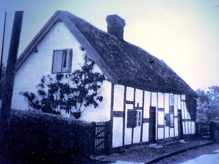
Clayhole Croft, Wrexham Road
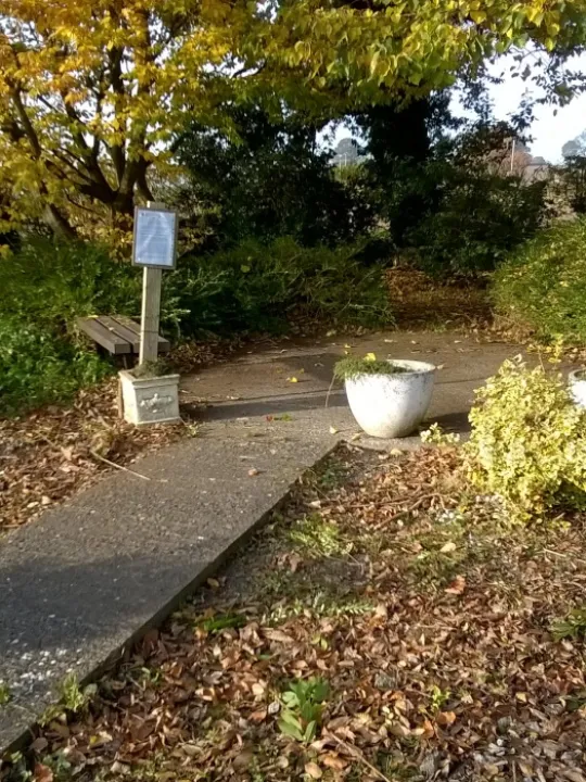
Have you ever wondered what the little piece of overgrown land is just below the Malpas Sports Club Ground entrance on Wrexham Road?
There is some interesting history attached to this triangular piece of land.
The earliest record of the land dates back to November 1767.
Richard Leech, John Bathoe and Mr William Pratchitt fined ten shillings each "for not scouring their ditches belonging to a water course leading from the High Road in Malpas near a place called the Clayhole Wrexham Road".
(Extract from: Cholmondeley Manor Court Records: Cheshire & Chester Archives & Local Studies REF: DCH/Y/9)
One of the uses of the clay that was extracted from the site would have been to make the 'daub' for the wattle and daub (known as 'clay windings' in Cheshire) used to fill the wall panels of timber-framed buildings.
After clay extraction had ceased, the clayhole filled with water and was probably used as a watering pit for horses and cattle using the Wrexham Road.
It is shown as a water filled pit on the Tithe Map of 1841. The owner and occupier at that time is recorded as the Reverend Charles Augustus Thurlow of the Higher Rectory.
Later the pit was filled in to become the feature that is still visible today.
Records indicate there used to be a pair of timber-framed cottages on the opposite side of the road, just slightly higher up Church Street towards the church, which were called 'Clayholes Cottages'.
One of them was the home of the Lawrence family, who moved to one of the new council houses in Springfield Avenue in 1949.
It is thought that the cottages were demolished in the late 1940s or early 1950s.
Because it had been a public clayhole, then a watering pit, the piece of land became regarded as common land and was registered as such by the Parish Council in 1970.
Because the Parish Council registered the land they also became responsible for its upkeep.
Article updated by
Chris Whitehurst
2nd December 2023
Quick Links
Village Map

Get In Touch
MalpasOnline is powered by our active community.
Please send us your news and views using the button below: